문화예술특별시
지역문화지수 평가에서 우수한 문화자원과 기반을 인정받은 도시 '창원'

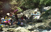
In the deep Yongchu Valley that extends for about 2km from Yongdong, clean and clear water flows throughout the year. It is also called “Yongchugol” because a farmer from Yongdong Village witnessed a thousand-year-old dragon ascend to the sky while he was working, and the mineral spring the dragon needed to gain the strength to fly again was named “Yongchusaem.” Legend has it that the Yongchusaem Spring was so deep that a coil of silk thread was not enough to reach the bottom. The forests are dense and clear water flows in this area all year round, and there are many amenities such as the deck road that make this place a popular tourist attraction.
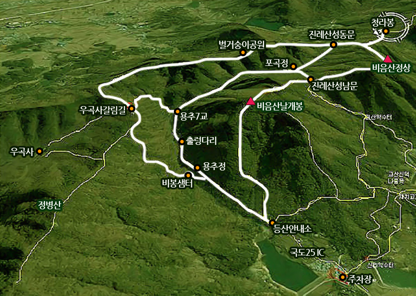
| Hiking Trails | Route | Distance | Duration |
|---|---|---|---|
| Trail 1 |
Information Center |
7.9Km | 2 hr. 20 min. |
| Trail 2 |
Information Center |
9.1Km | 3 hr. |
| Trail 3 |
Information Center |
6.2Km | 2 hr. 30 min. |
Main Facilities Along the Hiking Trails